
LOGAN COUNTY “High Expectations” 16-18 May 2025
An interesting thing about Logan County is that from whichever direction you enter it, you more or less head up in elevation as you progress to its center. It sure didn’t appear that way to us as we entered from the south along US Route 68. All around us were flat farm fields, but looks can be deceiving. More on the elevation a little later.
Soon after crossing the county line, our attention was drawn to a bronze statue on the west side the road. Erected less than a year ago, it depicts an armless man standing atop large stone blocks. Croplands and distant silos provide a backdrop. The memorial is to Andy Detwiler, known as the “harmless farmer” to his 147,000 subscribers who gained inspiration from his podcasts regarding the physical challenges life throws at you. At the age of 2, Detwiler fell into a grain auger on the family farm and lost both his arms. Overcoming such a daunting physical obstacle, Detwiler became adept with his feet to where he could drive a tractor, repair equipment, feed animals, and perform other necessary farm tasks. He passed away in 2022 at the age of 52.
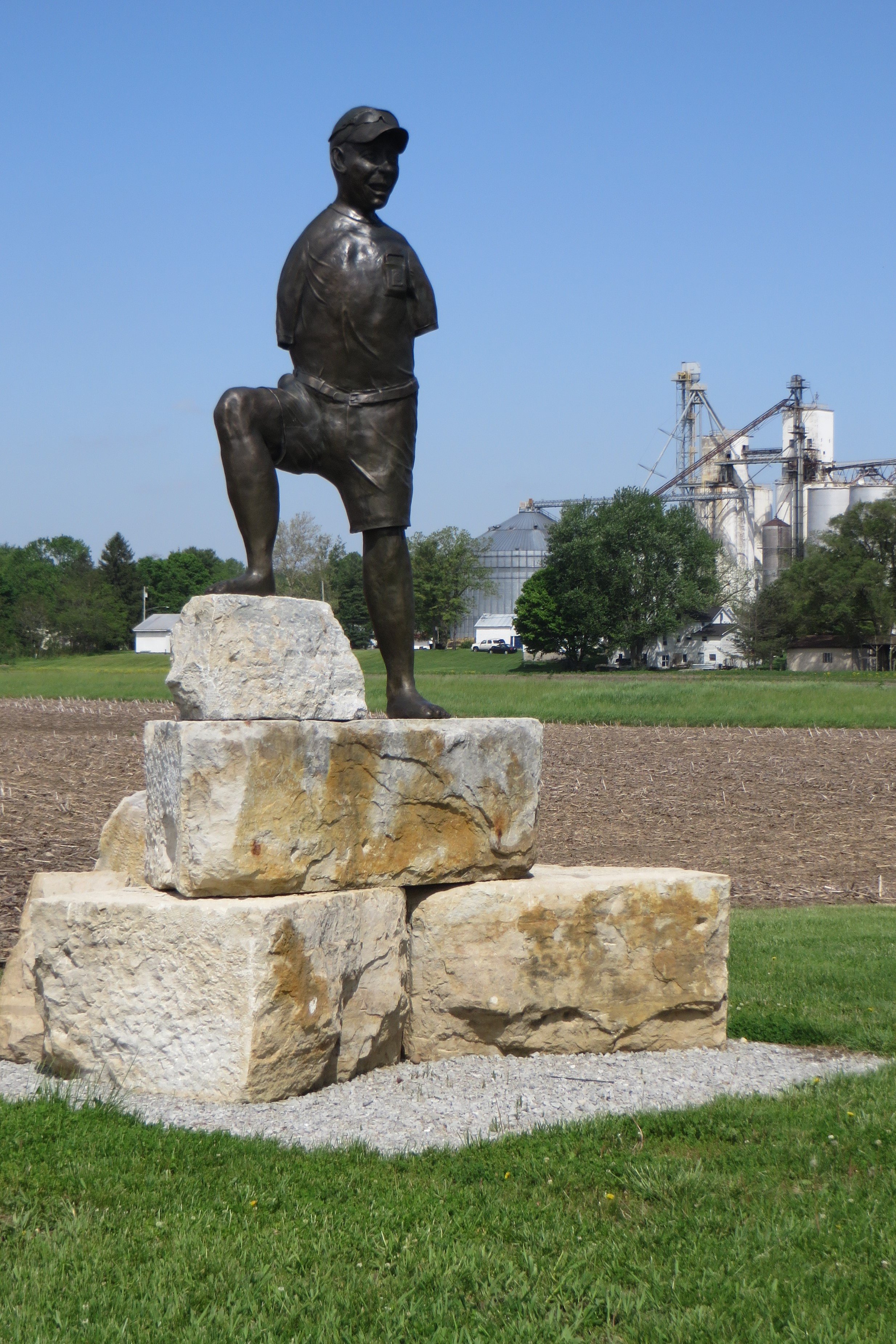
The “Harmless Farmer”
The memorial serves as a kind of welcome to the village of West Liberty. We drove up Detroit Street where we found our morning breakfast spot. The location has been home to many restaurants over the past 80 years, but since 1995, when Cindy Oelker purchased the property, it’s been known as the Liberty Gathering Place Family Restaurant.
We hesitated upon entering, not knowing if we should wait to be seated. A friendly regular helped us out. “You can sit anywhere,” he told us, and then jokingly added, “and then you’ll be dutifully ignored.” Our timing was good as many of the empty tables became occupied soon after our arrival. The wait staff hustled to take orders and remained cheerful while doing so. Many of the breakfast specials were named for cities, although I couldn’t figure out the connection. Michele ordered the Cleveland consisting of two eggs, toast, meat, and home fries. The Hungry Farmer Omelet caught my attention and rewarded me with ham, bacon, sausage, home fries, and cheese folded inside the eggs. A provided cup of salsa gave it a bit of spice.
After our satisfying meal, we checked out some businesses along Detroit. The Wicked Thrift Store is an interesting establishment. Not only does it offer a selection of used clothing and items you might find in any thrift store, but it also carries a variety of witchy retail items for all levels of interest in metaphysical, Wiccan, and Pagan traditions. There was also some LGBTQ+ merchandise, so I picked up some Pride stickers.
Nearby at the MCC Thrift Shop, I grabbed up a handful of 10 pens selling for 3 cents each. That’s what I call a deal!
Across the street, we poked into Ambrose’s Frontier Shop & Antiques, an eclectic mix of aged curios and period reenactment clothing. I didn’t find anything to buy, but if I ever want to dress up as a War of 1812 soldier or 18th century frontier scout, I’ll know exactly where to shop.
A few blocks to the north, at a fork in the road, triangular Veterans Park is home to the Purple Heart Memorial. The names of community members who received that military honor are inscribed on tiles.
The park also pays homage to the Shawnee Nation’s history in the area. An historical marker details what were the locations of Shawnee villages in the county and explains:
From the 1770s until 1832, the Logan County area was the homeland to much of the Shawnee Nation. Ten villages known as the Upper Mad River towns included the homes of influential leaders Moluntha, Black Hoof, and Blue Jacket. The West Liberty area contained three villages: Moluntha’s Town, Wapakoneta, and Mackachack. To the northeast stood Wapatomica, the Shawnee’s political center and site of several intertribal councils. To the north sat Blue Jacket’s Town, Kispoktha Town, and Reed Town. To the west were Pigeon Town and Stony Creek, site of one of Tecumseh’s first pan-Indian confederacy councils. From 1817 to 1832, many Shawnees were relocated to Indian Territory, which in 1907 became the state of Oklahoma. These Shawnees are now the Eastern Shawnee of Oklahoma.
While on one hand, it appears a respectful memorial to the original inhabitants of this land, on the other hand, it feels a tad patronizing considering that the name of the county honors Colonel Benjamin Logan who, in 1786, led a force of Kentucky militia against several Shawnee settlements along the Little Miami and Mad Rivers. His campaign resulted in the destruction of food supplies and the burning of 13 villages inhabited by women, old men, and children. (Most of the younger men were away defending other villages from attack.) Eleven people were killed and 28 women and children were taken prisoner. One of those murdered was Chief Moluntha who had signed a Peace Treaty with the United States earlier in the year. He flew an American flag over his lodge and when Logan’s forces attacked, he surrendered himself and his family while holding up a copy of the treaty. That didn’t stop one of the Kentucky militia members from burying a hatchet in his head. What become known as “Logan’s Raid” resulted in angering the Shawnees and escalating the fighting on the frontier.
Of all the Ohio counties named for Native American groups, none hold the name Shawnee. It would have been fitting for this county to have that distinction, but unfortunately, I wasn’t around to offer my opinion in 1818 when Logan County was established.
A couple of blocks north of the park, we stopped at Marie’s Candies, a confectionary established in 1956. Its retail shop is housed in a 1926 train depot that Marie’s purchased in 1993 and moved to its current location. As soon as we entered, the alluring aroma of chocolate filled us with pleasure. We were enamored by the vast variety of sweetmeats. I felt just like a kid in a…well, you get the analogy. Our purchases included a package of chocolate-covered bacon, a white and yellow “deviled egg” made of chocolate, and a line of “Chimney Sweets,” a triple blend of chocolate, caramel, and white coating that resembles a snow-capped smokestack.
We finally left West Liberty behind, driving west and north on a series of county and township roads. This brings up a criticism and a suggestion I have for the county engineer. While motoring throughout the backroad hinterlands of Logan County, it would be a tremendous help to visitors to have signs posted at intersections identifying the names of the road one is on and the road one is passing. There are indeed signs confirming the road name AFTER one turns onto it, but in my humble opinion, that’s a tad too late to be a benefit. Just saying…
Successfully following the lines on our county highway map though, we found our way along the curving and dogleg route of Township Road 32 to McCracken Fen Nature Preserve. A small pull-off provided us a place to park before investigating the mown grassy paths of the preserve. We followed one of them back to a kettle lake. These wetlands were originally formed from the melting ice of retreating glaciers. The area was more recently mined for peat and marl before the Ohio Department of Natural Resources purchased 94 acres in 1999 in order to preserve the marshy ecosystem. In the distance, I spotted a mound of mud and sticks that looked suspiciously like a beaver’s den.
Bush honeysuckle was prevalent along many of the paths we strolled. The shrubs contain pretty white and yellow flowers, but are also considered an invasive species in Ohio, often displacing native plants and drastically altering a habitat. They hadn’t yet blocked out the white and yellow fleabane nor the violet dame’s rocket, which also colored our hike.
The highpoint of our nature walk may have been the turtle we came across in the middle of our path. As we got closer, it retracted most of its appendages into its shell, as though to say, “Move along, nothing to see here.” As soon as we passed, the legs popped back out and got running for the safety of denser foliage.
Back in the car, we continued west across the county, mostly along Township Road 45. That led us to the village of DeGraff, home to about 1,250 residents. We turned north onto Main Street, which becomes County Road 24 once it leaves the town limits, and roughly follows the upstream path of the Great Miami River.
After just about three miles and a left turn onto County Road 21, we pulled off at the Whipple Through Truss Bridge. The 143-foot-long metal cage-like span was built in 1882 and carried traffic over the Great Miami River until it was bypassed in 2020. The Whipple through truss design was developed by Squire Whipple in 1847 after he developed a formula that calculated the actual stress on the trusses of bridges. This led to long-span bridge designs that were popular through the late 1800s.
While we were out of the car and marveling at the bridge, we heard the familiar clip-clop of a horse-drawn wagon. We looked up to see an Amish driver making his way over the more modern, less interesting-looking bridge. I didn’t realize Logan County had an Amish population, but later learned there were 738 adherents recorded in the 2020 U.S. Census. Most live in the vicinity of Belle Center in the north of the county, but obviously, based on our observation, not exclusively. In fact, as we continued north on County Road 24 and Knight Road to our next destination, we came upon another Amish-driven horse-drawn cart. We slowed down before carefully passing.
About three and a half miles north as the crow flies along the Great Miami River, we found the McColly Covered Bridge on County Road 13. It’s a 125-foot single lane bridge that was built in 1876, but it still carries traffic, both gas- and horse-powered. There wasn’t anywhere near it to safely pull off the road until we reached a side road at the top of a nearby hill. The photograph I took of it with a telephoto lens includes an Amish house on an adjacent hill.

McColly Covered Bridge
We turned back east, and after a dogleg on Ohio Route 235, we were able to stay on County Road 13 for nearly 8 miles before reaching County Road 130. That road led us south to Logan County’s seat of government, Bellefontaine, the only city in the county. We weren’t yet ready to investigate its environs, so we drove west-to-east across Sandusky Avenue, a main thoroughfare that skirts the downtown.
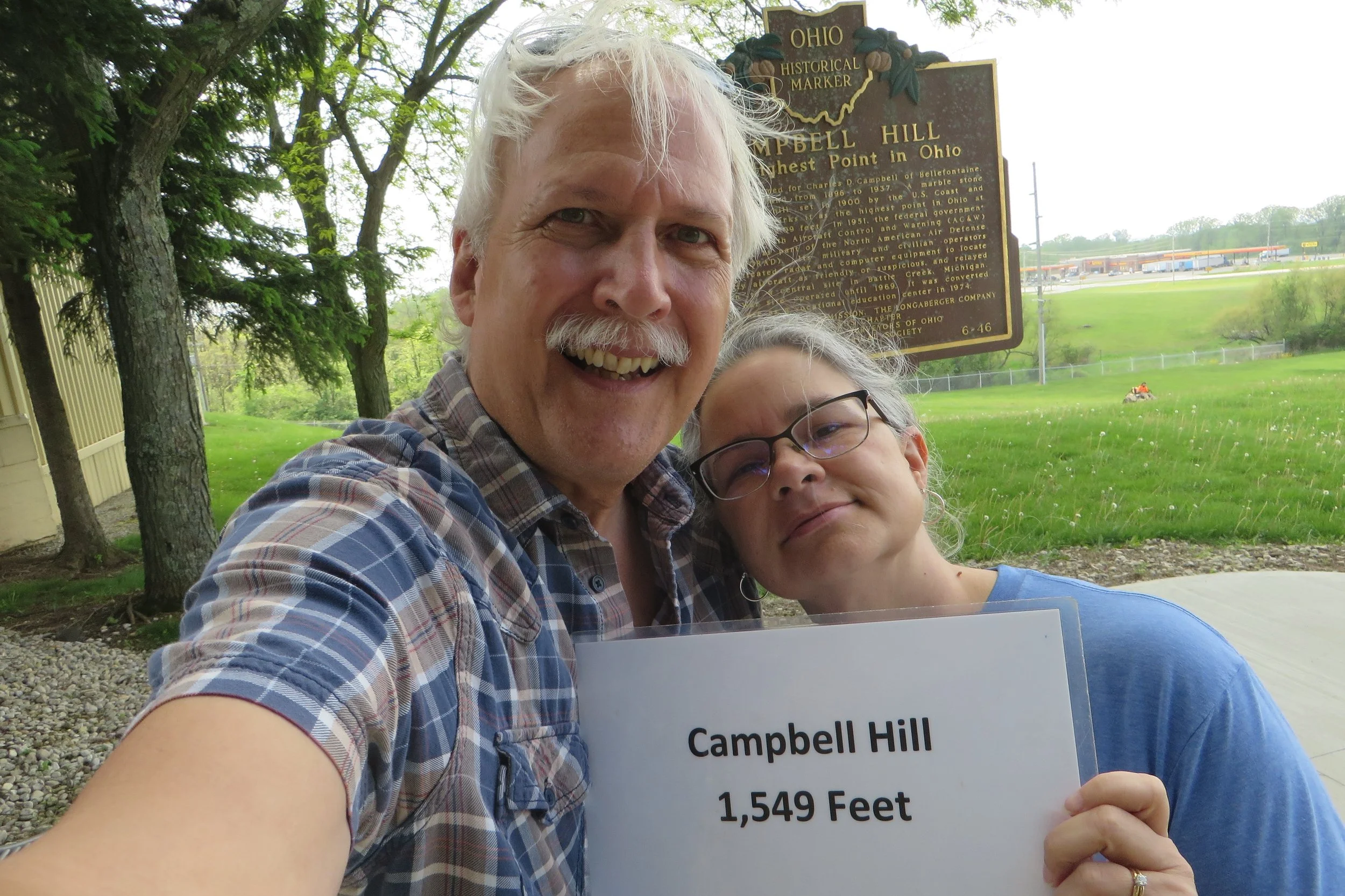
About a half mile after passing over US Route 33, we turned at the sign for Clark State Community College. Driving straight back for a ways, the road goes up and bends away from the Hi-Point Career Center before dead-ending at a few parking spaces next to two silos and a giant radar antenna. We had reached Campbell Hill, the highest point in Ohio!
I have heard that some folks are a bit disappointed upon reaching the ultimate elevation in the Buckeye State. Afterall, it’s not as though one needs crampons or Sherpas to attain this zenith, but as Michele and I stood there and looked “down” at our surroundings, we both thought it was a pretty damn cool site. As another visitor wrote in the guest ledger, “Everyone in Ohio is beneath me!”
Campbell Hill is named for Charles D. Campbell who owned the land on which the hill sits for nearly 40 years at the beginning of the 20th century. The historic marker on the hill says the elevation is 1549.09 feet above sea level as determined in 1900 by the U.S. Coast and Geodetic Survey. A marble stone marker was placed on the spot. However, next to it, a survey marker placed by the U.S. Army Corps of Engineers gives the elevation as 1548.81. Who’s telling the truth?! I suppose the generally accepted, and rounded off, 1,549 feet is good enough.
What is round on the ends and high in the middle?
If attaining the loftiest perch in the state isn’t enough enticement to get yourself up that hill, you may want to consider the footnote that Campbell Hill played in United States history. For nearly two decades during the Cold War, Ohio’s apex was home to the 664th Aircraft Control and Warning (AC&W) Squadron. It served as a part of the North American Air Defense Command (NORAD). “Its military and civilian operators used sophisticated radar and computer equipment to locate and identify aircraft as friendly or suspicious, and relayed information to a central site in Battle Creek, Michigan.” It closed in 1969, but an example of the large radar antennas used is on display atop the hill.
We retraced our route back to Sandusky Avenue and, just west of US-33, pulled into the parking lot for local radio stations WPKO (Peak Of Ohio) and WBLL, The Bull. The proper street address for the modest one-story building is 1501 County Road 235, but to me, it was Memory Lane. WBLL simulcasts at signals 1390 AM and 106.9 FM and broadcasts a country music format, but forty years ago, the AM station was known as the Mighty 1390 WOHP (Ohio’s Highest Point) and broadcast a mix of Christian music and programming. It was also the site of my first radio job. I can’t exactly claim the format conformed to my personal music preferences, but as a sophomore in college who expected to make a career in radio, I jumped at any on-air experience. For two years, I held down the Sunday afternoon shift. The station was licensed for daytime broadcast only, so my hours varied from about 4 hours in the winter to nearly 8 hours in the summer. So, how big was my listening audience? Well, one afternoon when I had a free T-shirt to give away to the first caller, the phone lines remained disturbingly silent. ‘Nuff said.
We kept our car radio tuned to The Bull for the remainder of the weekend.
Wistful reminiscing can build up a fierce thirst, so we made our next stop Roundhouse Depot Brewing, Bellefontaine’s first brewery. Located on Chillicothe Avenue, just a few blocks west of the city’s center, the brewpub, which opened in 2018, taps into the area’s railroad heritage. Not only is it located on the site of the Big Four Railroad depot, but it pays homage to the Iron Horse with its branding and décor.
Michele and I each ordered a flight of four beers which came in cute wooden replicas of a train engine. We rolled through a Caboose Cream Ale and a New York Express Coffee Porter, and chugged along with a Pullman Coffee Blonde and a Hobo Brew orange wheat. All the beers were good and we were digging the nice vibe of the place and the ‘80s rock soundtrack being piped in with the likes of Def Leppard and Judas Priest. That was right in our wheelhouse.
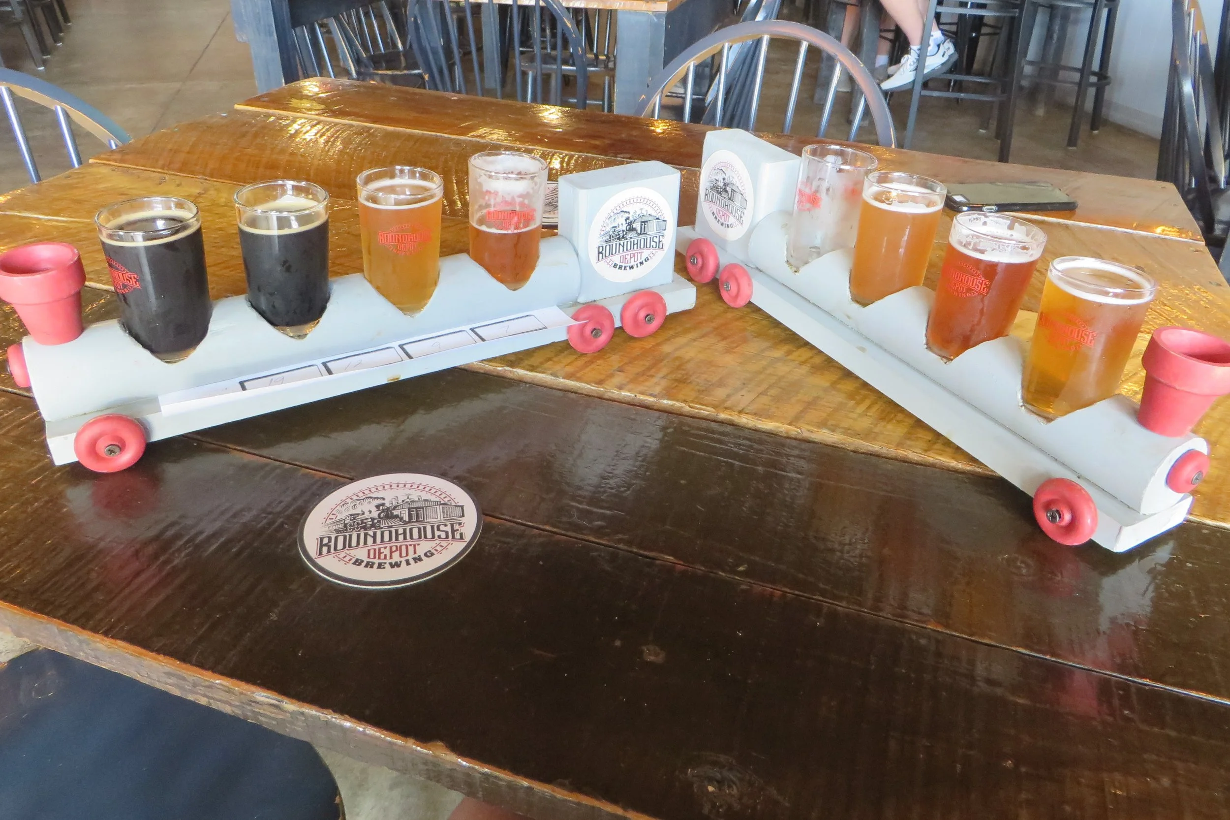
Beer.
We whittled away the rest of the afternoon in a pleasantly relaxed state of mind. But as the afternoon melted into early evening, hunger pangs began emerging, so we drove a few blocks to the east and found 2G’s BBQ on North Main Street. After being seated, we realized the restaurant exuded a heavily religious tone. The T-shirts worn by the waitstaff pictured praying hands, the back of the menu contained a religious testimony, and contemporary Christian music played from the speakers. But, by god, the food was delicious! Sweet pieces of cornbread were delivered to the table as a sort of appetizer. I followed that with an entrée of ribs that were literally falling off the bone, accompanied by sides of baked beans and collard greens. If we ever return to Bellefontaine, I prophesy a second coming to 2G’s.
We left Bellefontaine on Eastern Avenue and slowly descended along hilly County Road 10 and through the town of Zanesfield. After crossing over US-33, we began to gain elevation again up Snow Valley Road, circling the seasonal Mad River Mountain ski resort. After turns onto Alpine Valley Road and Timberline Road, we arrived at the appropriately named Mountain Top Campground and RV Park. One of the lots contained our lodging for the weekend, the Rusty Fig Tiny House Airbnb.
The Tiny-house Movement began in the late 1990s and early 2000s and promoted the reduction and simplification of living spaces. An example usually has an area no more than 400 square-feet. They are sometimes portable. While the Rusty Fig still retained a trailer hitch at one end, it was stably established with connections for electricity and in-ground plumbing. Its space was efficient with a small table and TV niche, kitchen facilities, and a queen-size bed up a ladder in a loft. The 6-gallon hot water tank provided 5 minutes of comfort in the shower. I’ve always been intrigued by tiny houses, but even after staying in one for a fun weekend getaway, I’ve concluded my long-term residential life requires more than 400 square feet.

Our Tiny House.
An unexpected concern for us that first night was a tornado watch issued for Logan County. It turned out to be the weekend of a major tornado outbreak that tore across portions of the Midwestern and Southeastern United States. It spawned 56 tornados resulting in 27 deaths. At least three waves of severe storms rolled over us in the night. As thunder and lightning raged, I pondered the wisdom of sleeping in the upper portion of a tiny house near the highest elevation in the state, but we were fortunate that no twisters formed in our area and our tiny house neither shimmied nor shifted even the tiniest bit during the storms.
Saturday dawned with cool temperatures, overcast skies, and buffeting winds, but at least the rain had passed. We got a late start due to a clogged toilet, but there’s no point in dwelling on that. (The Airbnb owners admitted that tiny house plumbing can be finicky. They took care of the problem while we were out for the day and we returned to find our plumbing was fixed. If only it was always that easy.) We retraced part of our route from the day before, passing through Zanesfield and Bellefontaine before turning north up County Road 130 and State Route 117. A left turn on State Route 366 led us to the village of Russell’s Point, the largest community found around Indian Lake, the second largest inland lake in the state (behind Grand Lake St. Marys).
We pulled up at the Landing Tavern with 15 minutes to spare before its breakfast service ended at noon. I took advantage of our timing and ordered a standard 2-egg, bacon, and toast meal to fortify myself for the next few hours.
What we know today as Indian Lake began as a series of small lakes and wetlands that were converted in the mid-19th century into a feeder lake for the Miami and Erie Canal. It was then called the Lewistown Reservoir. After the demise of the canal, the state developed the area for recreation and renamed it Indian Lake. During the mid-20th century, many waterfront properties became home to summertime cottages. In the past 50 years, more development has resulted in remodeled and newly constructed second or retirement homes, with some houses becoming year-round residences.
Many of the small lake islands have been connected by roads. We drove north on Orchard Drive across Orchard Island and onto Wolf Island where we found the “Tiny Post Office.” The small structure served as the first post office for the southern lake region. It lasted only a short period from 1912-1926, but the building was preserved, refurbished, and, in 2004, moved to its current location on a sliver of green parkland where it attracts visitors as a sort of whimsical historic oddity. Hey, it got us to visit.
We returned to OH-366 and began a circumnavigation of the lake, moving clockwise past several beachfronts maintained by the Ohio Department of Natural Resources. Turning east on State Route 235, we continued along the north side of the lake. I pulled off the busier state route and into the Avondale housing development just long enough to take a picture of Logan County’s Bicentennial Barn on the north side of the road. Ohio’s bicentennial logo is faded, yet quite visible on the east-facing side of the red gambrel-roof barn. It’s been over 20 years since Scott Hagan painted a Bicentennial Barn in each county and many have since disappeared, so it was nice to find this one still evident.
We continued east, but ran into a slight problem just prior to our turn south onto OH-117. One of the official rules of County Trippin’ is that once we enter the county, we can’t leave it until the trip is completed. While all of Indian Lake is contained within Logan County, the roads that wrap around it dip a toe into neighboring Hardin County for just over a half mile. We decided we weren’t going to turn back for that limited distance -- we could practically have held our breath for the time it took to drive it -- so we flagrantly defied the rules. I haven’t yet heard from the County Trippin’ Commission as to what penalty will be levied against me, but I’m hoping that since I’m self-reporting the infringement I’ll be let off with a simple slap on the wrist. Maybe I’ll have to pay a small fine or have to forfeit the first two journeys of next season’s county trips.
About four miles south – well inside the county! – we pulled off the road across from Duff Quarry, a provider of crushed stone, sand, and gravel. We weren’t in the market for any of those items, but stopped to get a better look at the two tall blue arches that advertise the business. Likely unbeknownst to most drivers who pass every day along OH-117, the 60-foot-tall structures have a worldly history. They originally belonged to a set of eleven “Peace Through Understanding” arches that were placed around the grounds of the 1964 World’s Fair held in Queens, New York. After the exposition ended, two of the arches were transported by rail to Russell’s Point intending to be set up at an amusement park. After sitting in weeds for a time, they were purchased by Jim Duff to be used at his business.

From the 1964 World’s Fair in Queens New York…
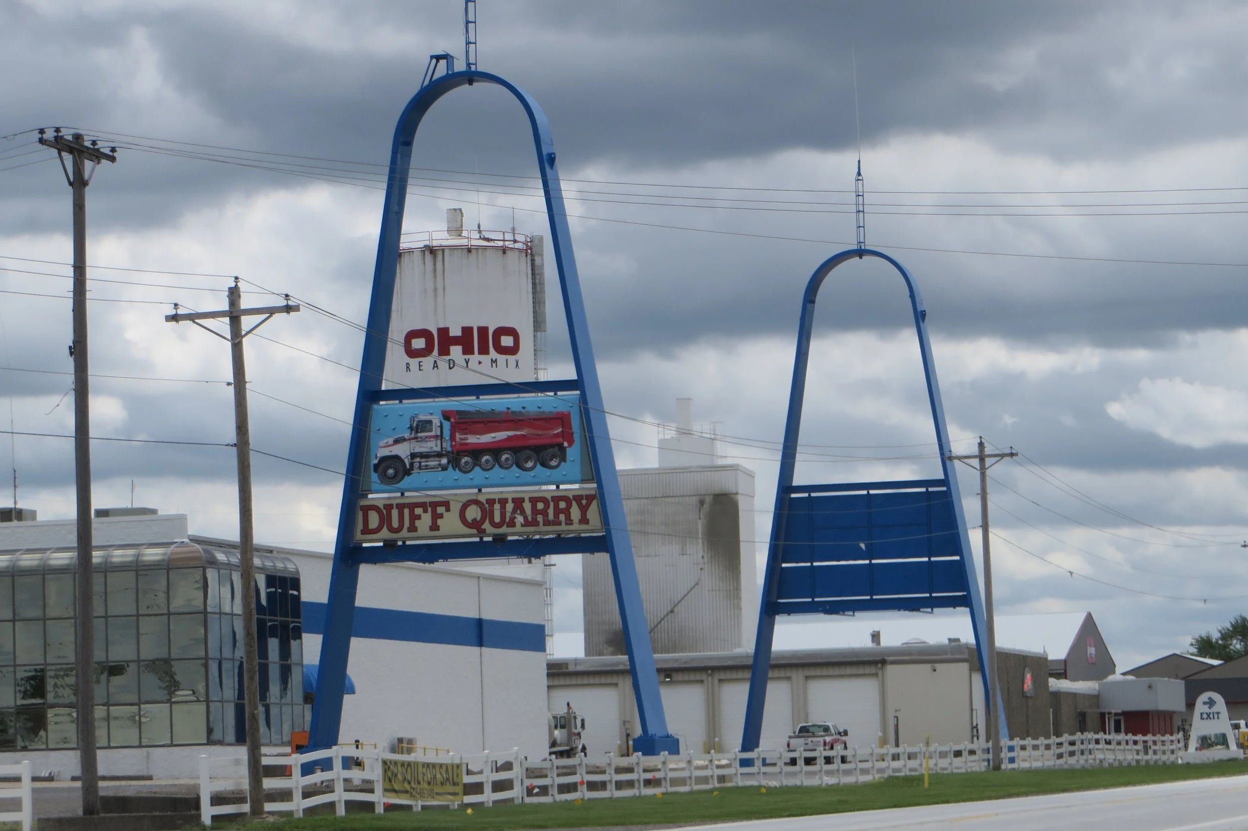
to the Duff Quarry in Logan County Ohio.
We turned again westward onto OH-366, completing our circle around Indian Lake, but detoured a third of a mile up County Road 38 in order to check out the Bickham Covered Bridge. We lumbered over its wooden deck that separated us from the South Fork of the Great Miami River before parking in a nearby gravel lot. The 94-foot-long span was rehabbed in 2002, so it looks in great shape for having been constructed in 1877. Pretty purple petals of dame’s rocket adorned the path that sloped down to the water. When we reached the bottom, we spotted two fishermen: one on the bank under the bridge and the other knee-deep in the river.
Less than a mile from the bridge, on OH-366, we turned onto Buckeye Drive. It connects another series of islands, many with Native American names: Shawnee Island, Seminole Island, Tecumseh Island. One of the exceptions is Pew Island, our destination. While housing occupies most of the islands, Pew Island has been left completely wooded as part of Indian Lake State Park. As we got out of our car, we were practically pushed back in by ferocious gales blowing across the 6,000-plus acre lake. The wind was so crazy that whitecap waves formed on the surface of the water.
Pew Island is a popular place among fishers as well as ducks who like to nest in its interior. A mile-long trail circles the island and as we made our way around, each cleared nook next to the water was occupied by one or two people hoping to hook something on their dangling lines. The wind was blowing so loudly as we strolled along the west side of the island that I couldn’t hear any of the birdlife, but once we made the turn to the east, it became as quiet as an unplugged amp and whistles and calls became evident. We heard catbirds and cardinals and spotted a red-winged blackbird that always endear me with their epaulets.
Closer to the path, we found more fleabane as well as perennial Virginia iris, white lace-capped guelder-rose, and golden ragwort. (Or was it butterweed? I’m not an expert.) As I stooped to take a photo of one of them, a hairy, bearded angler with a rod and reel in his hand passed by. He offered to walk into the woods so I could take his picture and claim I’d seen Sasquatch. I thought that was very generous of him, but I didn’t want him to risk ticks or poison ivy, so I politely declined.

Logan County Fleabane

Virginia Iris

Golden Ragwort? Butterweed?
We hadn’t hiked far enough to build much of a thirst, but regardless, once we returned to the car and checked the time, it was Beer O’Clock. We returned to OH-117 and drove south for a couple of miles, through the small town of Huntsville, and then turned west on County Road 37, where we found Camp Brewing. The property also includes cabins to rent and spaces for an RV or tent, but we were only there to do some day-drinking.
As one might have guessed, the welcoming décor was done up with an outdoorsy motif. Seating featured lawn chairs, picnic tables and benches, and spaces under white tent awnings. Other accoutrement included camp lanterns on the tables and stacked firewood. It was another brewpub with good beer, good vibes, and good music (90s alt rock).
When I went to the bar to order our 6-beer flights, which came in little red cooler-design carriers, I learned that the brewery had been open just over a year. Michele and I spent the next couple of hours enjoying the afternoon while sampling their varied beer list. I should have kept better beer notes that day, but I don’t remember any that were determined undrinkable. The camp-theme brews we tried included the Back Pack ‘N Brown Ale, Hoppy Camper, Pull Through Porter, and Summer Breeze Hazy IPA. Camp Brewing also offers arcade games, a pool table, and air hockey. Michele channeled her inner-Gretzky and beat me two straight games of the latter, 7-2 and 7-6.
We stayed on County Road 37 and drove east nearly four miles to connect to US Route 68 where we found the Ohio State Eagles Recreation Park. At its entrance is a small building shaped like a coffee pot. Built around 1936, it used to be a real café known as the Old Coffee Pot Restaurant. (What else?!) After it closed in the 1950s, it was purchased by the Ohio State Eagles who placed their logo on it. It’s missing its original handle and percolator-type knob, but there’s no mistaking what it’s supposed to be. I’ll stop for an architectural oddity like that anytime!
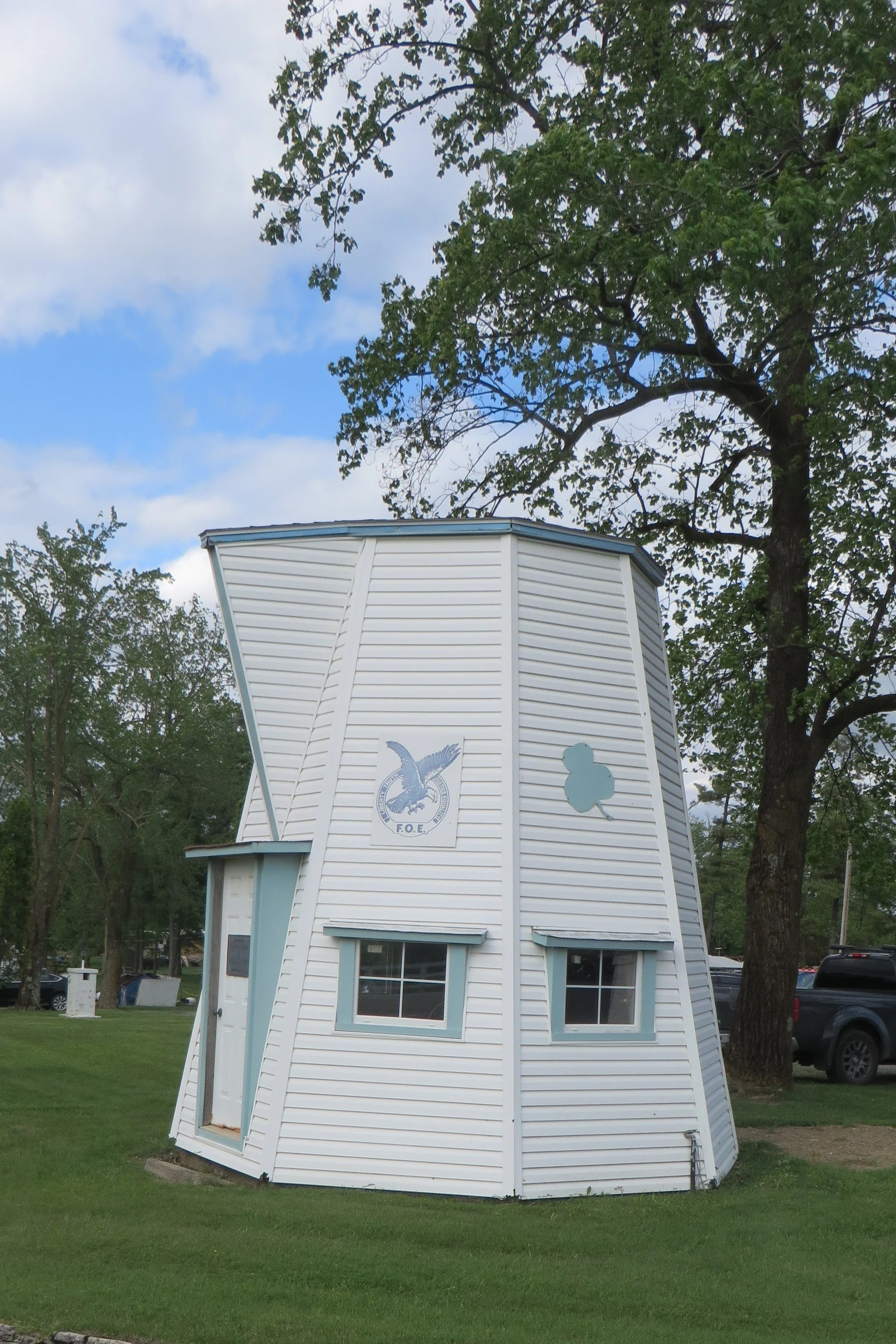
The Old Coffee Pot Restaurant
The afternoon was waning as we continued south on US-68 to Bellefontaine and then east to Zanesfield. This time, we stopped in the village of nearly 200 residents and had dinner at its only restaurant, Firehouse Pizza and Subs. We shared a Fireman’s Italian pizza, which comes with pepperoni, ham, salami, and cheese, and topped with lettuce, tomatoes, Italian dressing and mayonnaise. As the menu explains, “Think Italian sub on a pizza.” That’s exactly what it was and it was delicious.
We returned to our hilltop retreat and to the Rusty Fig Tiny House where Michele recognized how quiet and still the evening was. It felt especially noteworthy considering the severe storms we endured the night before and the turbulent winds from earlier in the afternoon. We spent a pleasant evening drinking coffee and binging on season one episodes of “Veep.”
The following morning, we were packed and heading downhill by 10:15. We returned to Zanesfield, but only long enough to take a few photos of historical markers. One was in a small park accompanying a 1997 log cabin replica of the one originally built in 1805 by Ebenezer Zane. This was the same Zane who, less than ten years earlier, had blazed the frontier road across the state that became known as Zane’s Trace. He was also the great grandfather of novelist Zane Grey.
The other marker appears at the south end of Sandusky Street on a large 70-ton boulder. It memorializes Ebenezer’s younger brother, Isaac Zane. A plaque explains that Zane, who was born in Virginia in 1753, was “captured by the Wyandot Indians in 1762, and carried to the valley of the Mad River. He grew to manhood among the Indians, and married the daughter of Chief Tarhe. He was the first white settler in the Mad River Valley, by nearly half a century.” Even though the he died three years before the official founding of the town of Zanesfield, he is its namesake.
Almost as interesting as Isaac Zane’s life is the story behind the boulder that bears the plaque honoring him. The giant rock came from a farm three miles east of town. It took two weeks for it to be moved on specially constructed trucks to its current location. A reinforced brace had to be applied to the bridge over the Mad River. Once it reached its destination, it took another five days to place it in an upright position. The boulder and plaque were unveiled in a ceremony in 1914.
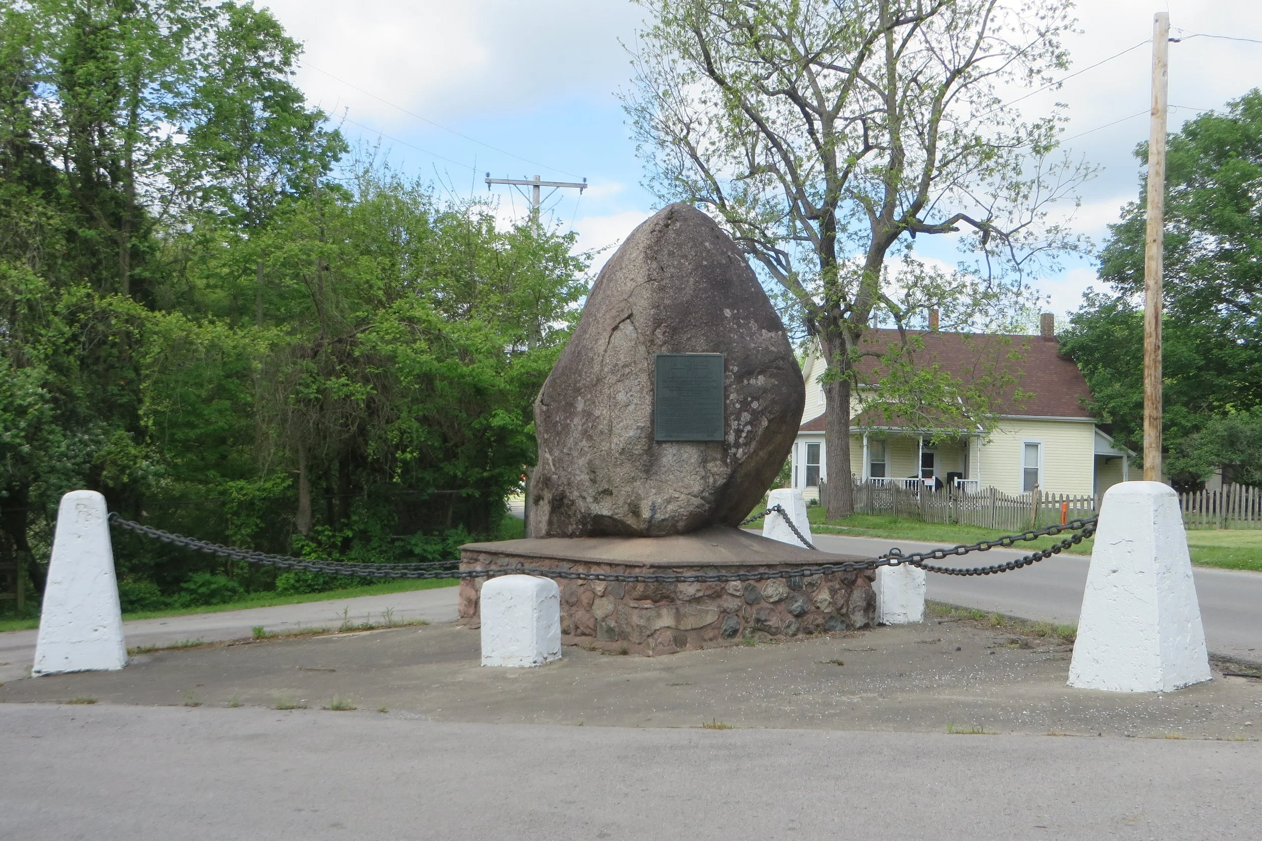
Isaac Zane Memorial
After our brief history lesson, we continued our way back to Bellefontaine where we parked next to the courthouse on Court Avenue. That particular block has the unique distinction of being the “oldest concrete street in America.” A metal arch over the west end of the street bears that claim. There’s also a life-size statue of George Bartholemew under the arch. He was the one who brought concrete to the Midwest and convinced the Bellefontaine City Council in 1891 to try his mixture in paving the four streets bordering the courthouse. He even posted a bond guaranteeing that his “artificial stone,” as he called it, would last at least five years. The other three sides have since been repaved with other materials, but Court Avenue has remained concrete now for over a century.
Half way along Court Avenue, we came upon another life-size statue…of Sasquatch! I couldn’t find a plaque or marker explaining how Mr. Bigfoot is connected to Bellefontaine’s history, but I had my picture taken with him nonetheless.
At the end of the block, we stepped into Sweet Aromas, a coffee and pastry shop that was opened in 2012 by Logan County natives, Will and Beth Zell. Our timing was good. Just after ordering our coffee, scones (bacon & cheddar and ham & swiss), and sticky pecan roll, and finding an available table, the line at the counter appeared to grow fivefold. The community gathering spot was doing a good business on that particular Sunday morning.
By the time we left, morning had become afternoon. We toured the city center on foot so I could photograph some of its more interesting architecture. First and foremost is the Logan County Courthouse. Constructed in 1870-71, its architectural style is considered to be Second Empire due to its mix of elements including a mansard roof and tall, dominating tower.
Cattycorner to the northeast of the courthouse is the Holland Theater. It was built in 1931 and is considered the nation’s only Dutch-themed theater. The front of the roof features a steep stair-stepped gable which is an element of Dutch design.
Two blocks north on Sandusky Avenue is a branch of Richwood Bank, but the building that houses it began life as a Carnegie Library. It opened in 1905 after a grant of $14,000 from Andrew Carnegie made it possible. It served as a public library until the 1990s.
Four and a half blocks west of Courthouse Square, along West Columbus Avenue, we found “the shortest street in America.” McKinley Street is only 15 feet long and connects Garfield Avenue and Columbus Avenue as the shortest side of a triangle. Quirky, thy name is Bellefontaine.
Before leaving the city, we did a little shopping at The Nest 1896, a combination antique/craft/boutique shop on West Columbus Avenue that takes up three floors of a renovated 1896 historic building. “Your source for all things handmade, vintage, antique and more!” states its website. We walked away with a wreath decorated with replica spotted bird eggs. It now hangs from our front door.
The final stop on our Logan County tour lay 9 miles to the south, so we left Bellefontaine behind and drove down US-68, returning to West Liberty before turning east on Baird Street. A mile and a half out of town sits the Mac-A-Cheek Castle. It is one of a pair of out-of-place homes built in the 19th century. The other is named Mac-O-Chee, and together, they’re sometimes referred to as the Piatt Castles as they were built by brothers Abram and Donn Piatt.
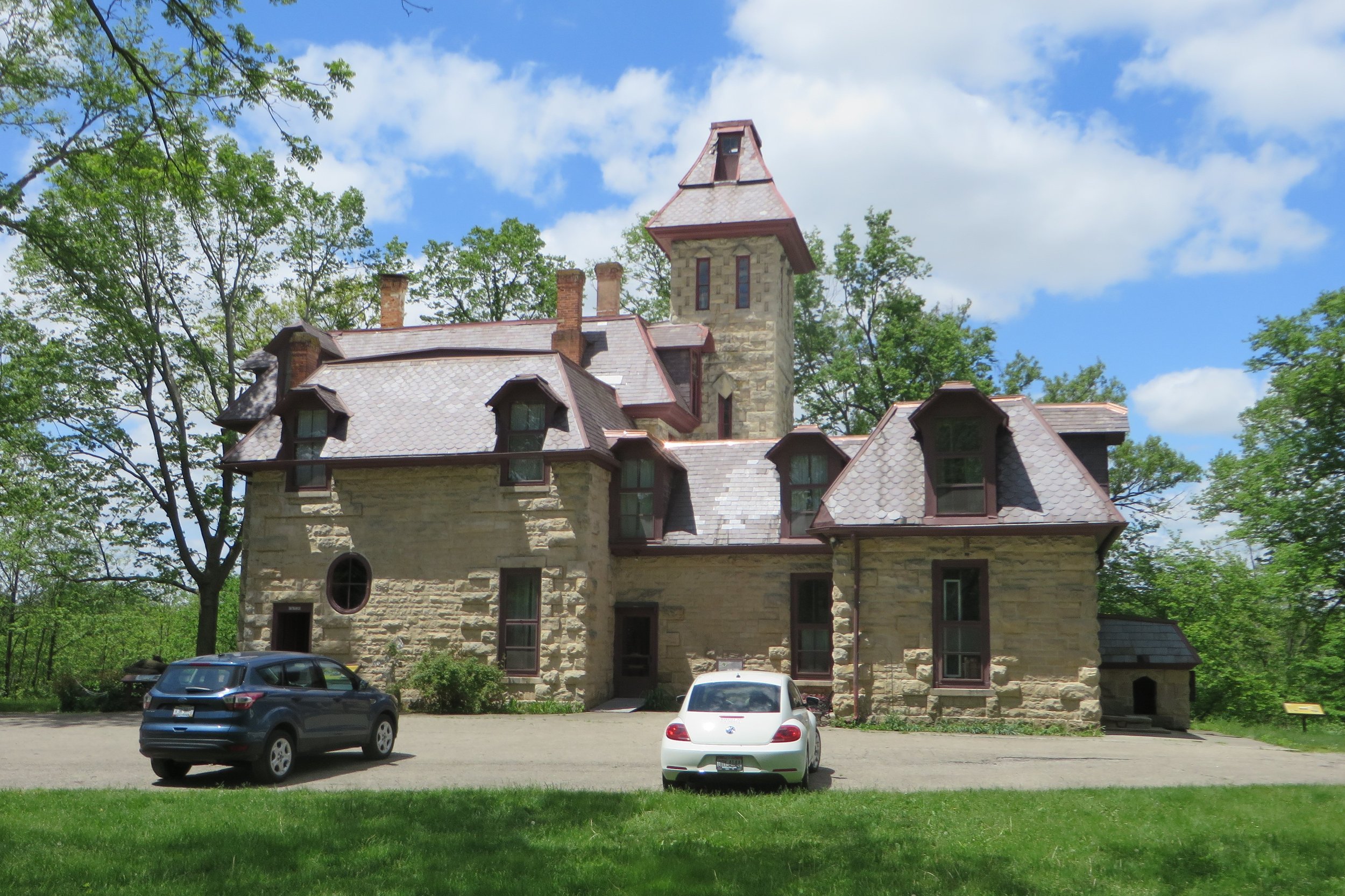
Mac-A-Cheek
Mac-A-Cheek was completed first, in 1871, and was home to Abram. It’s the only one currently open to tourists. Mac-O-Chee was finished a decade later by Donn and is currently used only as a wedding venue. Architecture for both has been described as Gothic Revival, although I don’t know that either are committed solely to a style. They were both constructed of stone and each contains a 4-story tower. I’m sure they were complete oddities when they went up nearly a century and a half ago.
Admission to Mac-A-Cheek costs $15 and entitles guests to a self-guided tour through about a half dozen rooms on two floors. A friendly docent is on hand to answer questions. I don’t think I’d recommend the site as a must-see. Even with a couple dollars knocked off for a AAA discount, the walkaround was underwhelming. It felt dark and a little dank. I’m sure if they tried, the owners could find some scouts who could earn service merit badges by sweeping up the dead insects from the window sills.
We were also welcome to walk the grounds, which we found a bit more rewarding. From the sound of it, a variety of birdlife calls Mac-A-Cheek home. We couldn’t always see them, but our Merlin birdcall app identified a Baltimore oriole, an indigo bunting, and various warblers.
Even though we couldn’t tour Mac-O-Chee, we drove less than a mile east to it in an effort to take its picture. Trees and electrical wires partially obscure the view, but at least I didn’t have to pay a fee to photograph it.
With the final sites ticked off our itinerary, we returned to US-68 and departed the county by the same route we came in.
Time spent in the county: 51 hours, 31 minutes
Miles driven in the county: 142
Penalty for leaving the county: A 6-month ban on county trip recruiting.